Dr. Johannes Schildgen is a professor of databases at OTH Regensberg university and a former Exasolian. With a background in computer science and applied sciences, he has a special interest in examining big (geo) data. In 2020, he was asked to be the supervisor for former OTH student Mario Stelzer’s master thesis analysing global geo-data.
A project with big ambitions
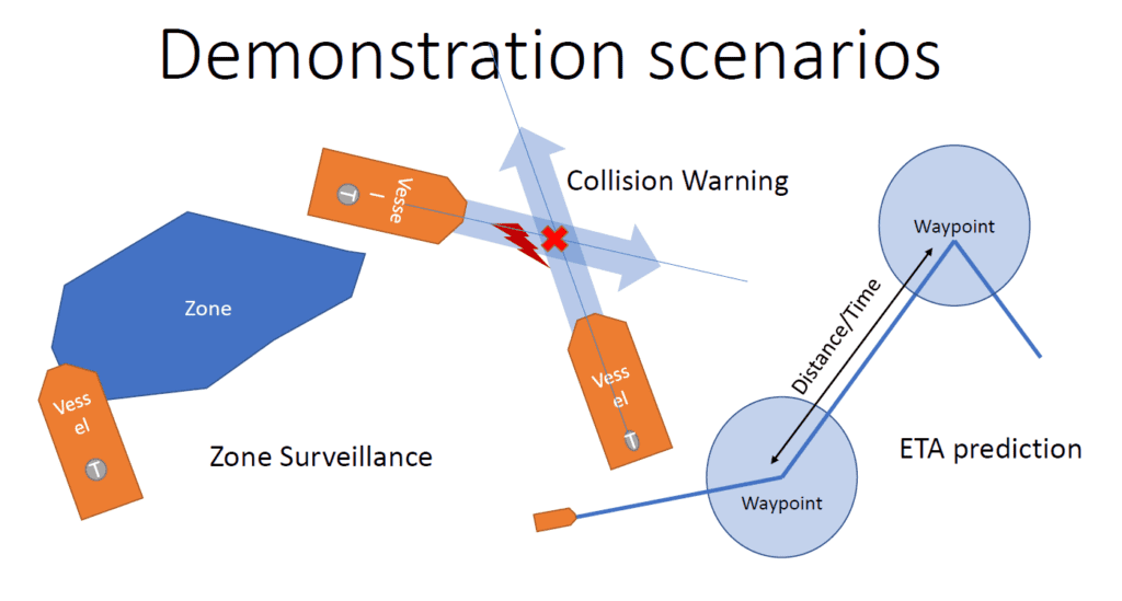
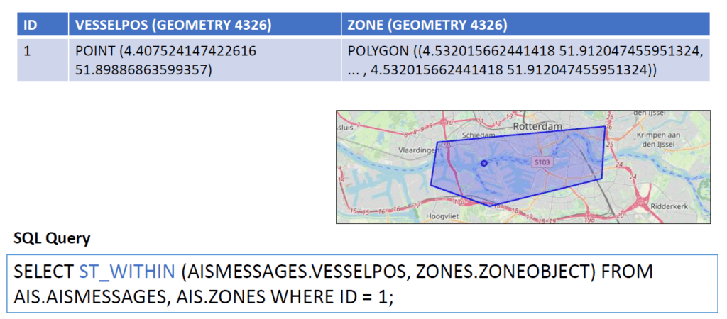
Approached by a transport company, Stelzer was asked to understand how geo-data can help better optimise ocean shipping. For example, could he apply Loading...advanced analytics to Loading...big data to warn about transport delays, discover where ships were and whether they might collide?
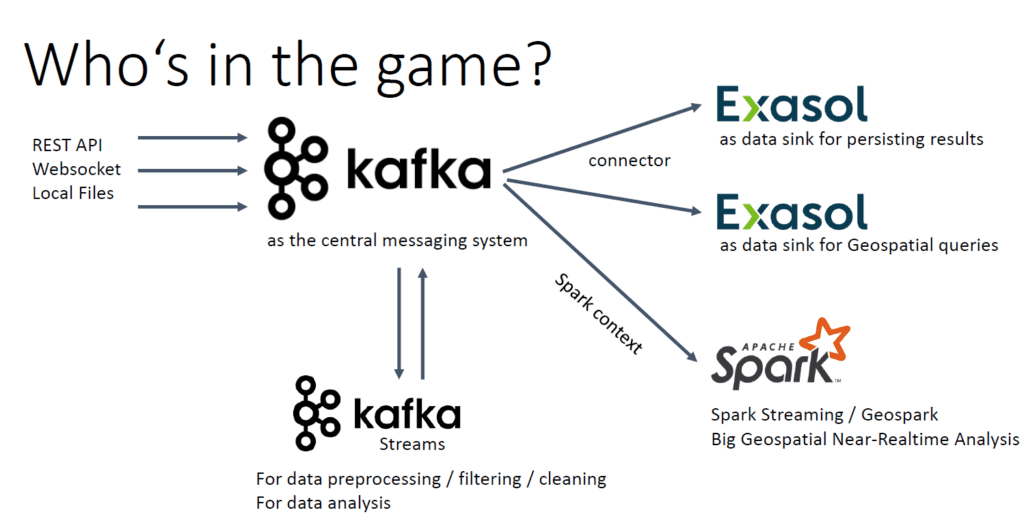
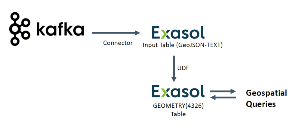
The three main players in his team were Exasol, Apache Kafka and Apache Spark. Both Apache products are well known and widely used in the area of stream processing, which means data is processed immediately on ingestion.
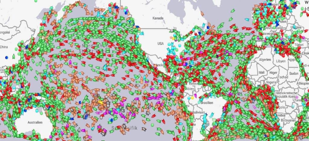
100,000 ships per day
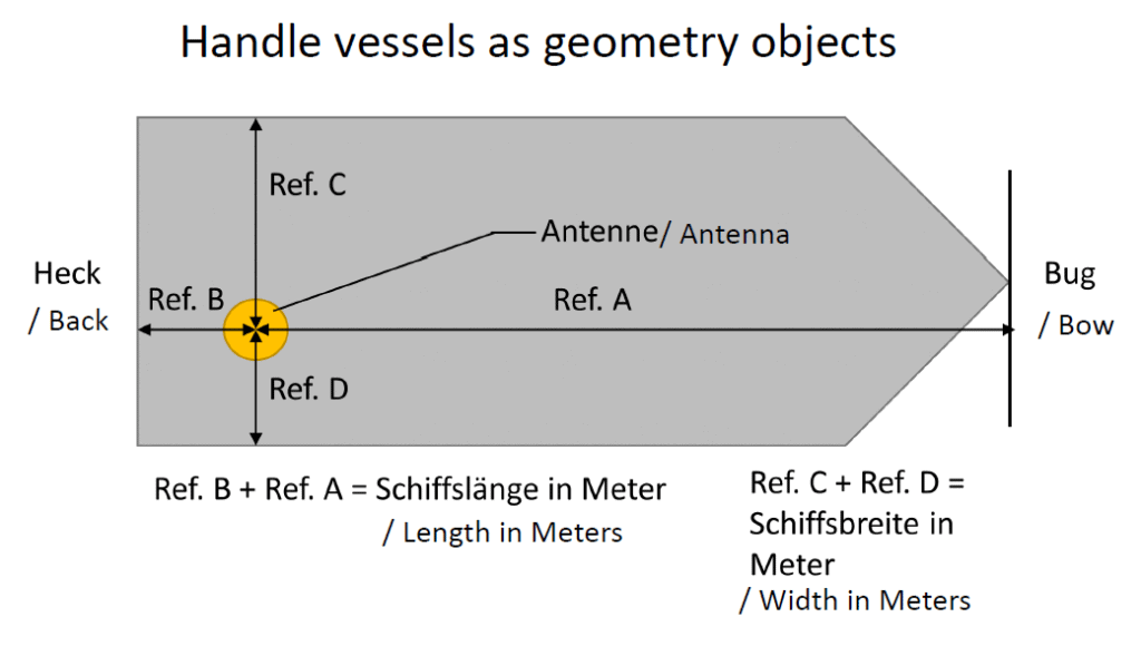
Geo-data in action
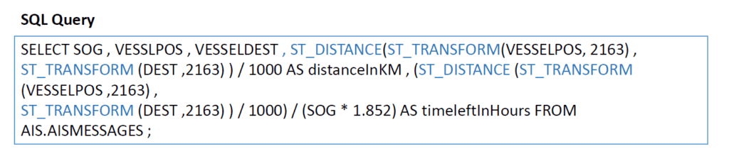
With an infrastructure in place, Stelzer put the data to work. Exasol’s ability to analyse high volumes of data in near real-time means it is possible for him to calculate how long it might take a ship to reach its destination. Pair this with other data sources, such as weather predictions, and there’s potential to avoid storms or save fuel based on wind speeds.
Uncovering the potential of geo-data using Exasol
The real-world applications of this project are compelling. Combining Exasol, Apache Kafka, and Apache Spark has enabled Stelzer to take a deep dive into near real-time streaming geo-data, applying it to a complex problem yielding fascinating results.